I-10 at 90 Miles Per Hour
It's 12 hours and roughly 600 miles from Tucson to Creel. If you do the math, that's less than 45 MPH. Driving at 90 miles per hour isn't going to improve your time because once you leave the I-10 interstate at the Benson turnoff, you're only 45 miles from Tucson, and now you're forced to slow down enough to enjoy the drive. You'll pass the turnoff to Apache Powder just before the Mormon town of St. David. Apache Powder makes dynamite and in the mining state of Arizona, there's a big demand for dynamite. Fishermen having a bad day have also been known to employ it discretely. In fact, up until the mid '90's it was still available over-the-counter in the Mexican canyons. An ex-pat friend remembers buying some in Batopilas- on his bicycle. The store proprietor suggested putting the dynamite and blasting caps into separate panniers! Fifteen minutes from Benson, the quiet Mormon town of St. David sits on the banks of the San Pedro River. This north flowing river disappears periodically in deep gravel bars, but here numerous springs and the river are the lifeblood of the huge cottonwoods that shade the road. Off to the east are the Dragoon Mountains. Many an Apache battle was fought here, but recently it's the owners of ranchettes who are fighting with movie companies who favor this picturesque location only a hour ride by buckboard from the Boot Hill Cemetery in Tombstone.
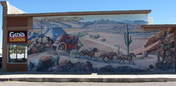
The Town Too Tough to Die
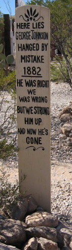
Tombstone hosts daily reenactments of the "Shootout at the OK Corral". The Earps and Doc Holiday had a disagreement with the Clantons that benefitted nobody more than the undertaker. Nowadays, there are stagecoach rides and ice cream parlors to benefit the RV'ers. Saloons slinging swill benefit the hoards of Harley riders with butterflies plastered on their teeth. Barely 25 miles away is Bisbee. The Lavender Pit just south of town used to be a mountain of copper. An army of miners led by Phelps Dodge fulfilled WW1 copper demand, and the population soared to 9000. Today it's an artist colony, and renowned for the Bisbee 1000, a fun stair climb with the finish line in one of the towns numerous bars. The Copper Queen Hotel, with its Victorian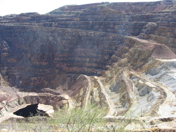 architecture is a town landmark, but hidden gems can still be discovered such as the Apache Spring Cafe or Shady Dell Trailer Park, where you can rent a night in a 1949 Airstream or a drydocked cabin cruiser after dining at Dot's.
La Frontera
Not even 20 minutes away is the border, and the sister towns of Douglas, AZ, and Agua Prieta, Sonora. This is it. Tank up with gas, although new PEMEX stations dot the route with quality unleaded gas. Take a deep breath and enter Agua Prieta - Dark Water. Down here Tecate rules over Budweiser, and tacos are served on soft corn tortillas. Things slow down even more in the towns, but on the road lead-foot locals careen wildly around blind turns. But not always on the straightaways. Why not? The reason is that in this mostly rural area, there are lots of speed bumps called topes. Watch out for these. Usually they're marked but if they aren't and you hit one going too fast, you might not be going much farther. Watch for other cars slowing down for no reason; also people frequently wait for busses, sell fruit, and ask for donations for various causes at topes where they know you have to slow down.Paperwork, Paperwork
If you're going this deep into Mexico, you need to get a visa and a temporary vehicle importation hologram. The visa is about $20 and requires a passport or birth certificate copy. The hologram requires a credit card, driver's license, and valid vehicle registration. As of 2012, about $350 will be charged to your credit card. This will be refunded as long as you stop and turn in your hologram on your way out; otherwise you will forfeit it after 6 months! Mexican insurance is not required, but it is wise to have it. You can shop for insurance rates online in the states. After you go over the speed bumps and through the "Nothing to Declare" lane, park behind the building on the right, and go inside to the desk in the Aduana (immigration) building. If you have over $10,000, don't use the "Nothing to Declare" lane. Now you're on your way. Leaving the Aduana parking, make a left heading east 4 blocks (parallel to the border fence), and then right (South) at the green sign. At the "T" intersection in less than a mile, you'll encounter Highway 2, the main east-west route in northern Mexico. Go left (East) towards Janos. It's about 2 hours to Janos barring major slowdowns in the two mountain ranges you go through. The second range is the border with Chihuhua and the continental divide; you'll cross it again going west - just east of Creel. Minor slowdowns, such as rigs hauling double trailers, can be frustrating. Evidence of major slowdowns can be seen beside the road where the guardrail is missing. Keep your eyes on the road and two hands on the wheel, at least through the mountains.
El Berrendo
After the second mountain range, you enter the plains Chihuahua desert. Slowly, agriculture is replacing the prairie dog towns. Sixty kilometers from Janos is a large nondescript intersection. From here, it is 11 kilometers to the large nondescript border crossing of El Berrendo/ Antelope Wells, New Mexico. On the U.S. side is 60 miles of wide pavement to I-10. On the Mexican side is 10 kilometers of pavement. This is a fast border crossing, and it would be heavily used if not for that one kilometer of dirt road. Down in the town of Janos, go right (south) at the "T" intersection, towards Casas Grandes. You'll probably be inspected just south of Janos to verify that you have a hologram, and there could be a military checkpoint mostly checking northbound traffic. There's a bypass around Casas Grandes to the left, or you could turn left at the south end of the city park; and if you're hungry, on the right 2 blocks past the PEMEX gas station is a popular taco stand. Food and Gas at one stop, how civilized!! Continuing past the taco stand, make a right onto the highway towards Cuauhtemoc and Buenaventura. In about 15 minutes, you'll bear right off the pay (TOLL) road to Cuauhtemoc towards Galeana and Buenaventura without ever having had to pay a toll. Turn right at the light in Buenaventura, across from the plaza and the church. Shortly you'll enter a sinuous stretch of road through another small mountain range. Trincheras dot the landscape. These are mortarless, rock wall fortifications, some very old. Back on the plains you'll go through Pena Blanca, Ignacio Zaragosa, and Gomez Farias. Just south of Gomez Farias, keep your eyes peeled for a right (west) through Babicora. Babicora was the ranch headquarters for Randolph Hearst's huge tract of land stretching to the north and south. Lots of gringos (cattle barons, railroad magnates, etc.) were buying vast acreage recently vacated by the Indians, but it didn't sit well with locals who had generations invested in it. The Mexican Revolution ensued. Chihuahua is the proud birthplace of this land reform and of the revolution. At the "T" intersection past Nicolas Bravo "Y" intersection, turn left for Matachic and Temosachic; not right for Madera.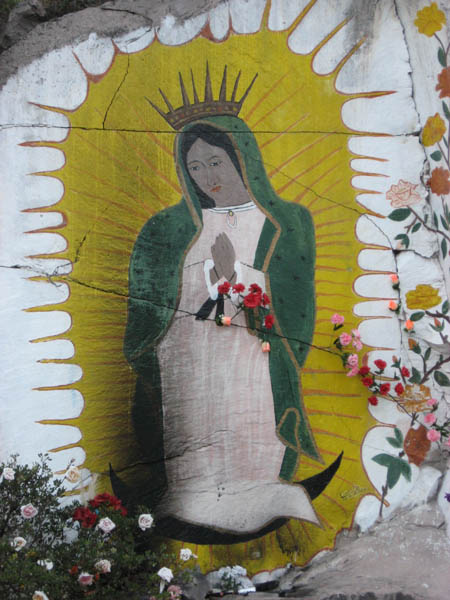
Papagochi Valley- Apples Basket of Mexico
Entering Guerrero, turn right at the first stop sign. On the left in the block before the park on the right is the store Teporaca. This is a good place to get groceries and avocados, and next door sells beer. Teporaca was the Tarahumaran Indian who led the 1652 revolt against the Jesuit Missionaries and Spanish colonization. Turn left at the far end of the city plaza for La Junta, twenty minutes or so away. Exit right (west) off the new Cuauhtemoc freeway at La Junta for Creel and Basaseachi, and notice the food stalls before the PEMEX. If you're still hungry, pull into Tio Beto's for an order of tacos. This is the number uno place for quality street food in the sierras, and Tio Beto is famous for political tacos!! Just stop and ask.The Sophistication of San Juanito
Less than 3 hours to go!! At the San Pedro junction go left for Creel and San Juanito; straight ahead for Basaseachi and Hermosillo, Sonora. In San Juanito, keep you eyes open for horse-drawn vehicle-chassis wagons. Talk about recycling. This windblown lumber town at almost 8000 feet gets cold in the winter, but the pinesmoke gives off a warm, homey smell. Turn right for Creel at the far end of town; and left at the "T" in front of the PEMEX. The right turn at the "T" is the newly paved road to the Mexico's highest and third highest waterfalls at Parque Nacional Cascada de Basaseachi. If it's getting late, we recommend Cabanas Noritari only four kilometers away; right at the "T" and on the left. You've got to try their "country gourmet" food sometime, but that's another story. Also, the owners' rent quaint cabins powered by solar! Pass through Bocoyna, a Tarahumaran word for turpentine, and the gateway to the Jesuit boarding schools in Sisoguichi.The Continenetal Divide
There's a couple of climbs before Creel. One of them is the continental divide. The Rio Conchos and the drainages around Bocoyna flow to the Rio Grande, Rio Bravo in these parts. All the other rivers flow to the Sea of Cortez. If you notice the Virgen de Guadalupe painted on the rock on your left, don't forget to stop and give thanks for a safe trip. As you pass the electrical substation on the left, you're fast approaching Creel. Take the cobbled fork to the left, and the next left, likewise cobbled. A sharp right will lead you under the RR overpass and to the main plaza in town, passing the train station on the right. As you enter the plaza, turn right. The hostel Margarita's is now behind you. The Mission Store is on the right. This is the only place to get topo maps of the area. They have a good selection of books about the Tarahumara, and a great selection of crafts. They buy from the locals and pay a fair price. The proceeds from all sales benefit the mission hospital.
| DRIVING DISTANCES | MILE/(km) | Elapsed Time | BETA |
| TUCSON | 0/(0) | Andale Pues... | |
| BENSON | 46/(73) | 0:45 | More Coffee! |
| DOUGLAS/AGUA PRIETA | 123/(196) | 2:05H | Gas up in Douglas, Vehicle Hologram and Visa! in AP |
| JANOS | 228(364) | 4:30H | Turn Right |
| NUEVO CASAS GRANDES | 270/(432) | 5:30 | LEFT on Av. Juarez (End of Park); Change Money (Banks on left, Casa de Cambios on Rt) immediately after tracks; Gas (left), Rosa's (rt) has good tacos. RIGHT at "BYPASS" to Cuauhtemoc/Chihuahua. |
| BUENAVENTURA | 322/(515) | 6:45 | Turn Right at the Plaza |
| PENA BLANCA/BABICORA Turnoff | 378/(604) | 9:00 | Turn Right for Madera/Guerrero |
| MADERA Turnoff | 400/(640) | 9:35 | Turn Left for Guerrero/Creel |
| GUERRERO | 430/(688) | 10:45 | Turn Right, La Teporaca (left) has good groceries, Left at end of Plaza |
| LA JUNTA | 445/(712) | 11:00 | THRU the intersection, Gas at PEMEX, Tio Beto's has delicious Tacos |
| SAN PEDRO | NO INFO | NO INFO | After climbing from the Rio Papagochi bridge, turn left for San Juanito/Creel, straight for Cascada Basaseachi/Hermosillo, Sonora |
| SAN JUANITO | 493/(789) | 11:50 | Last Right at the end of Town, Left at the PEMEX "T"; or right for Noritari, San Lorenzo, Basaseachi |
| CREEL | 512/(819) | 12:20 | BIENVENIDOS |
| DIVISADERO/POSADA BARRANCAS | 555/(888) | 13:00 | 1st Right leaving Creel, for Mansion Tarahumara, San Rafael |
Copper Canyon Trails, LLC ― www.coppercanyontrails.org ― 1334 West Pennington Street ― Tucson, AZ 85745 ― Phone: 520-324-0209